|
This is my favorite time of year!, the sun is warm , buzzards glide on invisible thermals, the days are long and Noctilucent Clouds became apparitions across mid Summer night skies. However it's during the daytime when I'm most attentive during the Spring and Summer months, this is when I feel most keenly focused with eyes glued to online charts and watching the skies for atmospheric 'cauliflowers'. This is convective season, when thunderstorms, convective cloudscapes, funnel clouds, and occasionally even tornadoes make their transient appearance. Although it's still only early Spring the conditions are now developing for vertical updraughts and Cumulonimbus clouds.
Sunday April 13th looked to be one of the best days of the early season with a trough crossing N. Ireland during the mid to late afternoon aiding with atmospheric lift in conjunction with decent solar heating and enough moisture for showers and a few storms. CAPE values ranged from 100 to over 400j/kg with 0-6km shear and up to 40 knots of deep layer shear. However factoring in the surface flow of 10 knots or less the actual effective shear would be 30 knots which is not only more than sufficient for multicell storms but also for supercell traits. The instability would be moving NE through the day however so based on timing with that prime heating I suspected the N and NE had the best chance of thunder. The AROME and GFS both modeled strong cores over the Sperrins by mid afternoon then more over NE Antrim by early evening just inland from the coast.
Chasing was my priority this day however I also had my own personal plans. My Wife Roisin and I where planning a day at the north coast, we would be meeting her Mother and Sister for dinner then heading for a walk afterwards. I could have done my own thing but decided to go along for the day to the coast, which I considered a decent target area for a storm anyway, or at least might see something of interest. We began our drive N with sunshine, blue skies, and developing but small towering cu, it was when we passed Swatragh that I noticed quite a few isolated showers breaking out over the NE in Co. Antrim, more than the AROME showed for this time, this was encouraging, it also indicated that area has the correct ingredients for convective development. When I see this happening earlier in the day I keep note as this is nature's way of saying pay attention as that area could produce again later in the day in greater style.
We had dinner near Coleraine, outside the sky was uninspiring with towers seeming to struggle, they also looked capped, maybe the trough and upper temps of -30c would help in a while. After dessert we began to drive to the coast, anywhere was game, Benone/Downhill?, or the Portrush side?, I was driving so I decided to try the Portrush side, the reason being that the models showed cells near that area based on the angle of the SWly flow, it was an instinct so I went with it. We drove through Portrush then onto the beautiful coastal route looking over the ocean with Dunluce Castle, Skerries, and Giant's Causeway in the distance. I glanced over my shoulder looking towards the SW as I drove and saw a dramatic sky, I could only steel quick glances as I was driving but I alerted Roisin's family to the sky and they looked out the rear windows for me, they all said the sky looked dark and menacing. I took another look and there was no question about it, a big cell was behind us inland and it was very black below, to me it looked like a storm. We pulled into Portballintrae and stopped to check radar.
 |
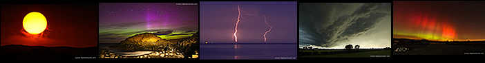
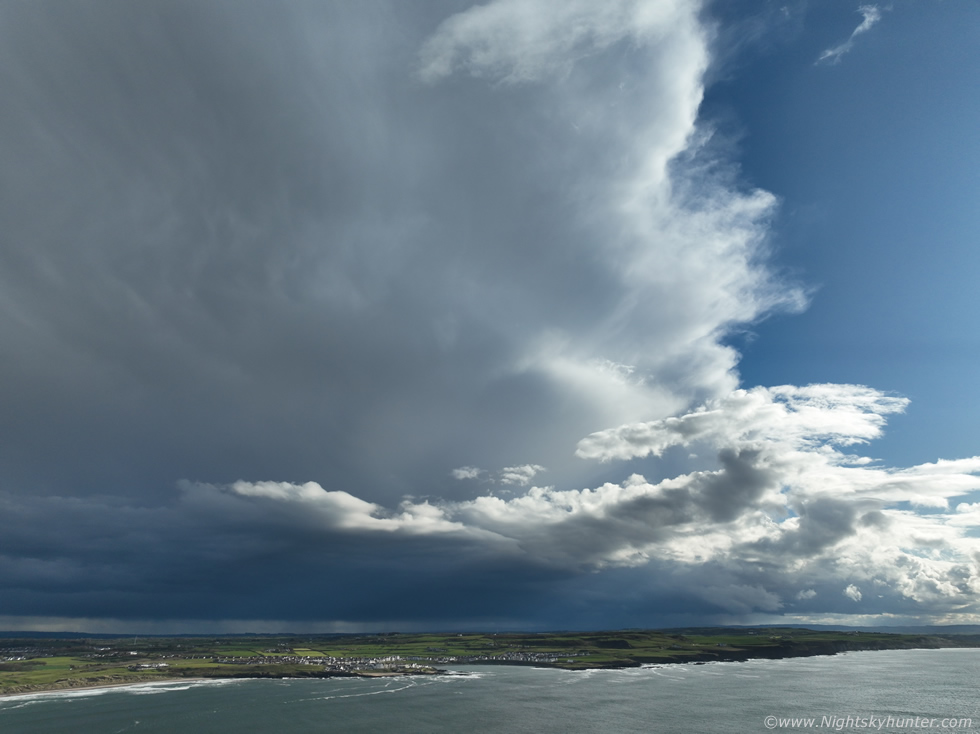
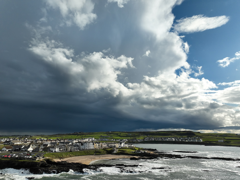
Radar showed two dominant cells, one was this one just inland from the coast, it had been over the Sperrins moving NE, I would later learn of reports of thunder from it from Glenshane/Dungiven and Limavady, it was now moving our way and had a big red core on radar. Behind it another cell with a red core was over the southern Sperrins west of my home area and it looked good and even bigger. Both cells were clearly sheared to the NE and sampling the 30 knots DLS. The town blocked my view of the clouds so I jogged across the car park to a nice hill of grass away from people and got the drone in the air. This was the view looking W/SW towards the storm, I had taken off from that closer headland, you can see Portballintrae with all the houses. The storm looked quite cool, I was not well placed as I was facing the downshear region of the cell with cloud and precip projected forward towards me but I could also see parts of the base and updraught to the left, in reality the clouds on the left where very dark and eye catching for that reason. I could hear what I thought was distant rumbles of thunder but thought maybe it was the surf crashing against the shore, but the rumbles matched up with the sfercs timing making this my first thunderstorm of the 2025 season.
 |
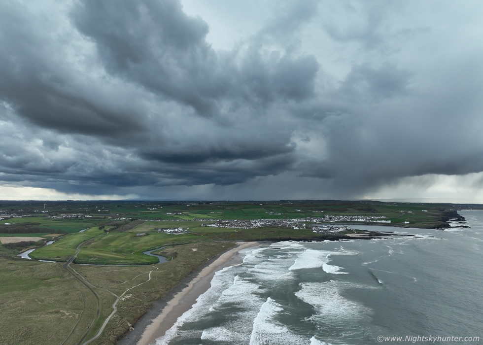
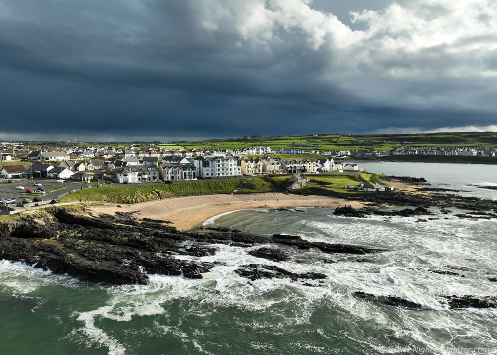
I watched the cell evolve, parts of the precip fell inland while other fresh precip curtains where already falling over the sea and the Skerries, it would soon be with us. Another image of the storm with the town and bay but by this stage the cell was much more outflowy and I heard no more rumbles, but that didn't matter, I was still delighted to capture a storm. I landed the drone as the first rain drops fell then ran back to the car to check radar.
Everyone was keen to get out for a walk but I informed them that we had to wait for this cell to pass, which would be soon based on its speed, and then it would dry up and we could get out for a walk, I also said another cell was approaching behind from inland but might miss us, I hoped to get a visual on that one soon. We watched rain curtains cross the ocean then it dried up fast and the sun was out shinning for a gorgeous evening. We all got out for some fresh air and headed for the beach, it was actually warm and comfortable and just a gorgeous day, everyone was enjoying it. I sat on the rocks for half an hour just chilling out when I looked behind me back inland, and there was the next cell coming into view, I was surprised how visible it's anvil was despite it's distance from us, it looked to be avoiding the coast and would pass us by but it was close enough to admire. The flanking area looked really cool and the rear side of the sunlit anvil looked more promising than what I thought I would see today.
 |
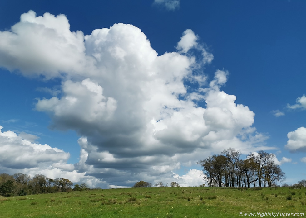
Drone in the air once again to get away from obstructions and enjoy a proper view. I was immediately struck by just how large the cell was, even though the main anvil looked fluffy the rear side was better and the updraught at the flank was solid, it also had a very long dark base extending along the entire sky for miles, I watched the cell with growing anticipation via the drone's RC screen.
 |
Five minutes later and it was huge, I had flown further back out to sea away from it and yet look at the size of it here, compare this image with the above image, just five minutes apart. It was obvious the thing was still growing and likely back-building. The anvil was so tall the drone camera couldn't tilt high enough to get it all in.
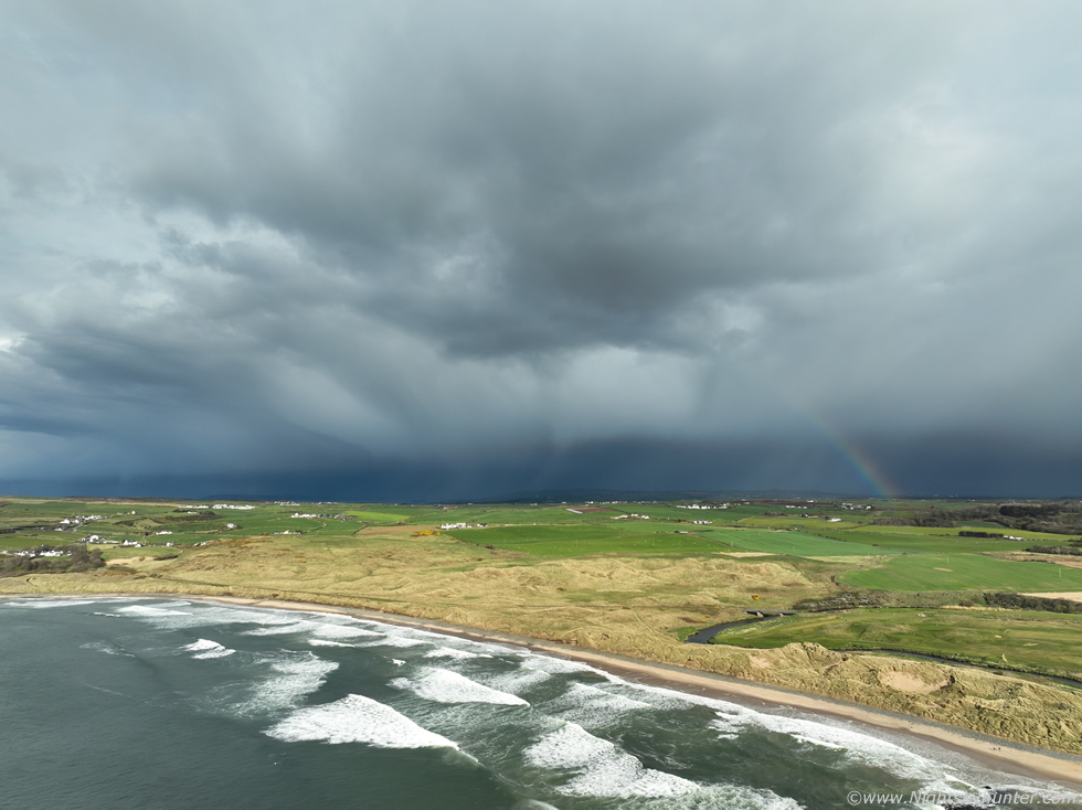 |
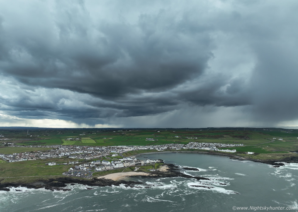
Panning drone 90 degrees to the left to show the middle of the cell facing inland, massive and very dark, a subtle rainbow joined the show. Then I began to hear those distant rumbles again, it had to be thunder.
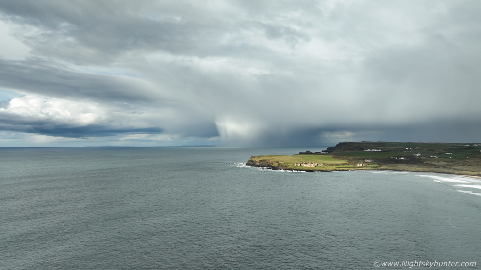 |
Continuing the pan to the left to the far end of what was now an obvious thunderstorm with sunlit hail curtains to the far NE heading over the sea and even over Rathlin Island.
 |
The flanking area was where all the photogenic action was, I flew out to capture it with Runkerry House but I could only get the famous building from the rear which wasn't the same. If I had been facing the front with the storm to the NE it would have been a cool scene, but I will take this anyway.
 |
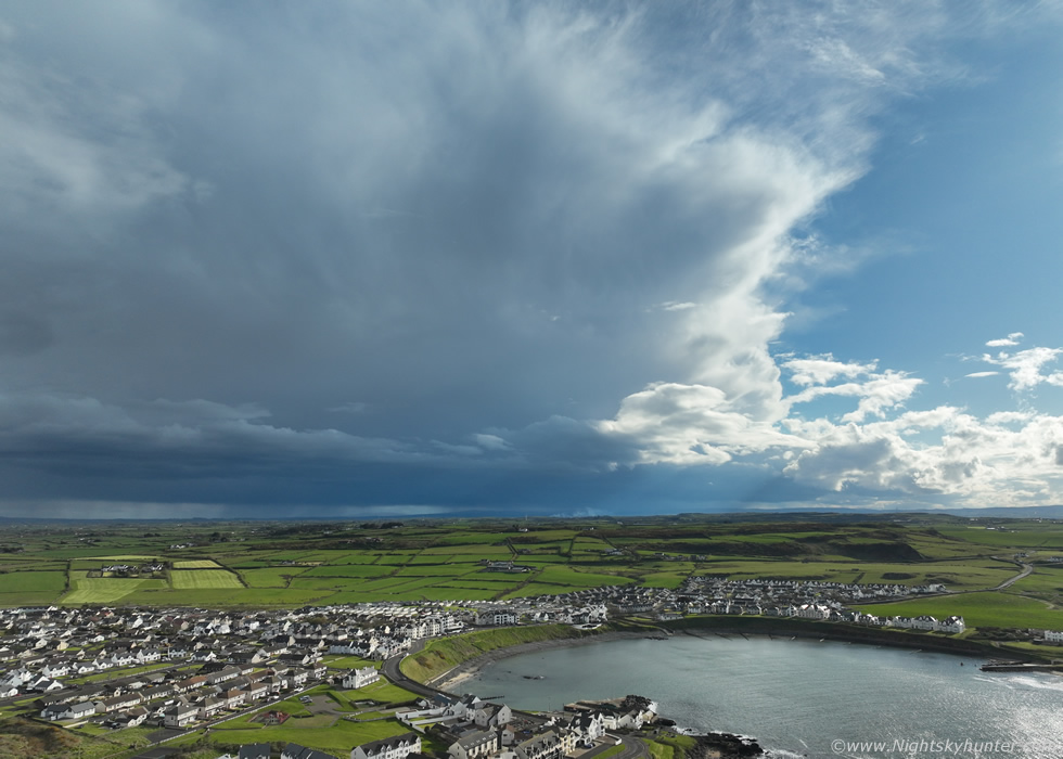
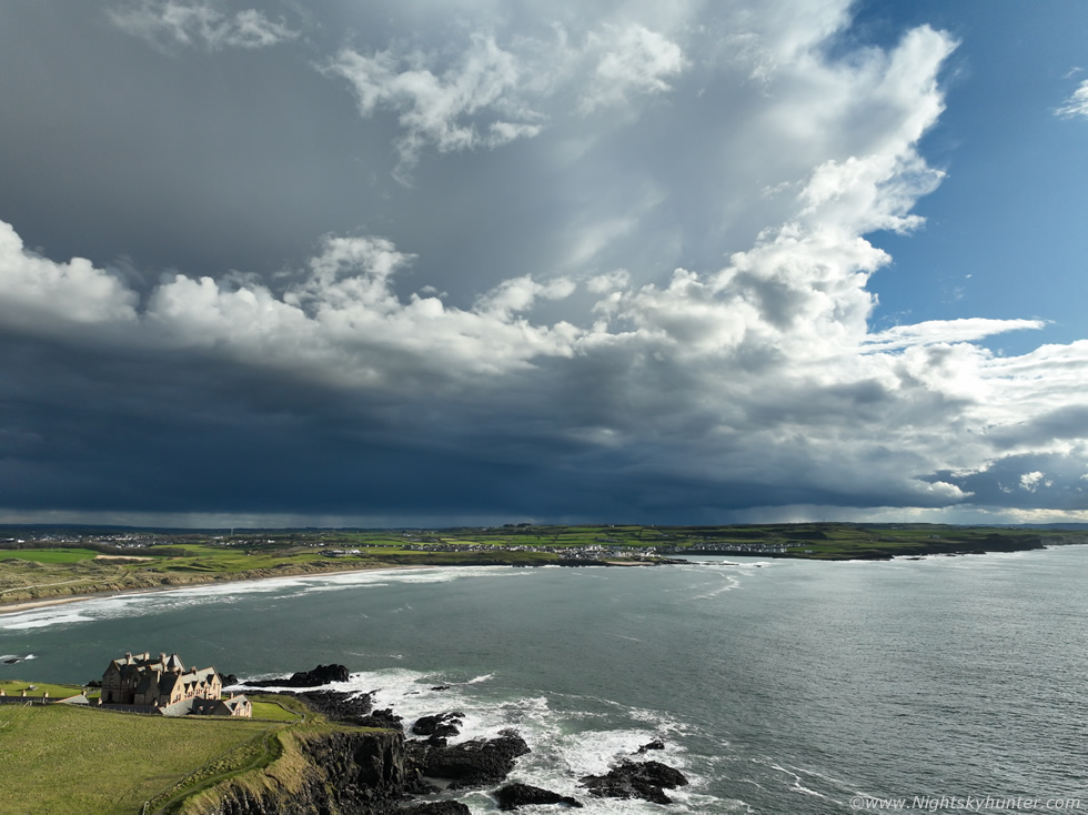
This was the scene of the day for me, the mean storm with base and anvil over Portballintrae, clear sky behind the anvil and the precip core and base was almost black visually. This was such a high contrast scene which doesn't happen too often, black core with hint of the classic thundery blue tones over the landscape with sunshine on the coastline. I was showing Roisn's Mum and Sister the view on the controller. Definitely the best structure scene I've got this season so far and may it be the start of bigger things to come.
 |
Ending the flight with an aerial landscape shot of the town and coastline. So radar revealed all, this was the second sheared cell, the one which was originally near the Sperrins and now just having crossed inland from the coast over NE. Antrim where c-g lightning sferics were recorded, it also produced lightning over the sea to the west of the islands off Scotland. My positioning today, and the output from the models, were all very accurate which doesn't always happen, just one of those rare days when everything works out. This was a fun and successful day with photogenic skies, nice light, and two thunderstorms experienced, I will certainly take that for early April.
 |
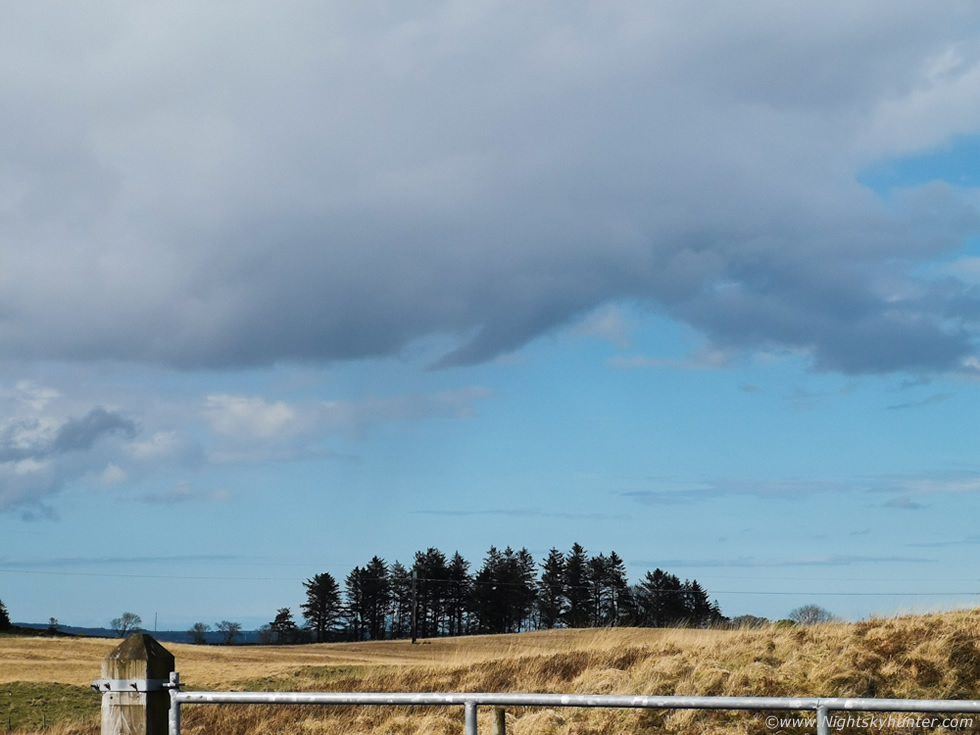
April 17th was another convective day but not even close to the last event, in comparison it was a sorry affair which most people would turn their noses up at. However, I have learned from years of doing this that weak set-ups and very low CAPE days can lead to surprises. I've seen beautiful storm clouds during this time of year before and impressive funnel clouds have been captured from Ireland on years past. This was nice sunny day with 50-100 SB CAPE (less ML CAPE) with only -15c tops on a Wly flow, wind was light at the surface but there was also notable 0-6km shear and DLS. There would be no thunderstorms today with the exception of a few well isolated showers, but there was a chance of small funnel clouds.
You don't need big storms to get funnels, if the conditions are rite they can form on fair weather days or even under capped convection. You just need some towering cumulus, light winds, low level CAPE can help, and surface convergence being the main factor. They can form suddenly under any cumulus congestus which requires a lot of hours watching the skies. I was walking near Moneymore around 13.00 when I saw my first funnel of the year under one such base, it was transparent and straight town, small but well defined along the edges, there was no question about what it was, but it was gone before I could even got the phone out, however it's presence indicated the day had potential. This was a phone snap of the same convection moving off into the distance.
Convection looked stronger to the N where higher ground was helping so I decided to go on an afternoon funnel hunt, I met up with Colleen Webb who was also chasing funnels. At first we targeted Glenshane where towers grew all around us, narrow hail shafts broke out and dark bases sat over the land, it did look to have potential, there were even red cores on radar under restricted updraughts. We re-positioned to the wind farm at Glenullin and watched new bases.
 |
I was chatting with Roisin on the phone when Colleen drew my attention to a lowering to the N/NE, was that what we thought it was?, that looked like a funnel!, I managed to shoot several images using the phone camera as I had no time to grab the DSLR and attach the long lens. This is one of ten images captured at 3x optical zoom. From what we could infer, the funnel was in a horizontal orientation and pointing away from us with a tapered point, it was very smooth in form. It was too distant to see rotation but based on appearance alone I made a judgement call on this one, it was very likely a funnel. You can just make out a light precip shaft to the left. So after four hours watching we bagged a suspected funnel, nothing spectacular but still good to see something so early in the season. The bigger days are on the way!, thanks very much for reading.
Martin McKenna